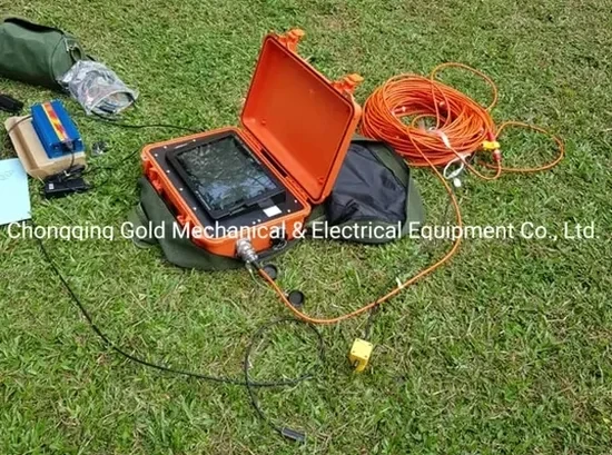
A 24-channel Geode system with 4.5 Hz geophones is our standard setup on the Wasatch Front. The spread gets laid out across the stiff Pleistocene gravels of the east bench or the deep lacustrine clays near the airport, depending on the site. We trigger a 12-pound sledgehammer for shallow refraction work and a 200-pound accelerated weight drop for reflection surveys that need to punch through 300 feet of valley fill. In Salt Lake City, the target is almost always the shear-wave velocity (Vs30) profile required by ASCE 7 Chapter 20. The geophone intervals shift from 10 feet for near-surface mapping down to 20 feet when we are chasing bedrock depth along the fault trace. Every shot gather gets inspected for first-break quality before the crew moves to the next spread. Raw data travels back to the lab the same day for iterative ray-tracing inversion using SurfSeis or SeisImager, calibrated against nearby borehole logs when available. For deeper reflection work on the west side, where the unconsolidated section exceeds 1,000 feet, we sometimes pair seismic lines with a resistivity survey to resolve the brine-saturated layers that distort compressional velocities.
A refraction line run too short on the west bench will misclassify 80 feet of stiff gravel as bedrock and overestimate Vs30 by 200 m/s.
Service characteristics in Salt Lake City
Risks and considerations in Salt Lake City
A five-story medical office building near the University of Utah hospital went through plan review with a Site Class D assumption based on old USGS maps. The structural design was complete — moment frames sized, footings detailed. We ran a single 230-foot refraction line on the actual building footprint and found a stiff gravel unit at 45 feet depth that pushed the Vs30 above 1,200 m/s. Site Class C. The lateral forces dropped by 18 percent. The owner saved $140,000 in steel tonnage because the tomography caught what the regional map could not resolve. The opposite scenario happens just as often: a parcel in the Glendale neighborhood near the Jordan River, where 60 feet of soft clay sits over a shallow water table at 8 feet. The Vs30 comes back at 480 m/s, putting the site solidly in Class E. The structural engineer must now account for amplified short-period accelerations. We have seen this pattern repeat across the valley, and it is why a liquefaction assessment often accompanies the seismic survey on these west-side sites — the same saturated silts that drop the velocity also trigger the Boise-type cyclic mobility that AASHTO warnings flag for the Intermountain West.
Our services
Every seismic tomography campaign in Salt Lake City requires supporting data to turn velocity profiles into engineering parameters. The two services below are the ones we most often coordinate with the geophysical survey.
Vs30 Site Classification per ASCE 7
Refraction tomography survey with minimum 115-foot spread, first-break picking, tomographic inversion, and conversion to shear-wave velocity profile. Deliverable includes a signed report with the Site Class letter (A–F), 2D velocity cross-sections, and a comparison with any available borehole or CPT data.
Deep Reflection Basin Profiling
Reflection survey using accelerated weight drop or vibroseis source, 48-channel split-spread geometry, and CDP stacking to image basin stratigraphy to depths of 1,200 feet. Used for site-specific ground motion analysis, basin-edge effect studies, and fault-zone characterization near the Wasatch fault.
Common questions
What does a seismic refraction survey cost for a typical commercial lot in Salt Lake City?
For a standard commercial lot requiring one or two 230-foot refraction lines, the seismic tomography survey typically ranges from US$2,450 to US$5,180. The cost depends on the number of spreads, the source type (sledgehammer vs. weight drop), and whether the site requires reflection profiling in addition to refraction. Sites with heavy traffic, dense vegetation, or asphalt that requires coring for geophone placement fall on the higher end. We provide a fixed-price proposal after reviewing the site plan and the structural engineer's seismic data requirements.
How deep can seismic refraction see in the Salt Lake Valley sediments?
With a 230-foot spread and a 200-pound accelerated weight drop, we routinely map velocity layers to 100–120 feet depth in the unconsolidated valley sediments. The practical limit for refraction in Salt Lake City is controlled by the energy source and the velocity contrast: the stiff Lake Bonneville gravels transmit energy efficiently, but the soft post-Bonneville clays attenuate the signal quickly. For depths beyond 150 feet, we switch to seismic reflection, which can image basin stratigraphy to 1,200 feet using CDP stacking methods. A downhole seismic test or a CPT with a seismic cone provides an independent check on the tomography results.
What is the difference between refraction and reflection tomography?
Refraction tomography uses critically refracted head waves that travel along velocity boundaries and return to the surface. It works best where velocity increases with depth — the typical case in the Salt Lake Valley gravel-over-clay sequence. Reflection tomography records near-vertical reflections from acoustic impedance contrasts and can image both velocity increases and decreases. We use refraction for Vs30 site classification and shallow bedrock mapping, and reflection when we need to define the deep basin geometry, locate the Wasatch fault plane, or identify a low-velocity sand layer sandwiched between stiffer units. Both methods produce a 2D velocity model, but the acquisition geometry and processing workflow differ substantially.
How long does a seismic tomography survey take on site?
A two-spread refraction survey on an open commercial lot in Salt Lake City takes one field day. The crew of two technicians lays the geophone cable, tests each channel, collects multiple shot gathers per spread, and demobilizes. Data processing — first-break picking, ray-tracing inversion, and Vs30 calculation — requires two to three additional business days in the office. A reflection survey with 48 channels and multiple shot points per spread may take two field days. The final report with signed Site Class letter is typically delivered within five to seven business days after fieldwork is complete.